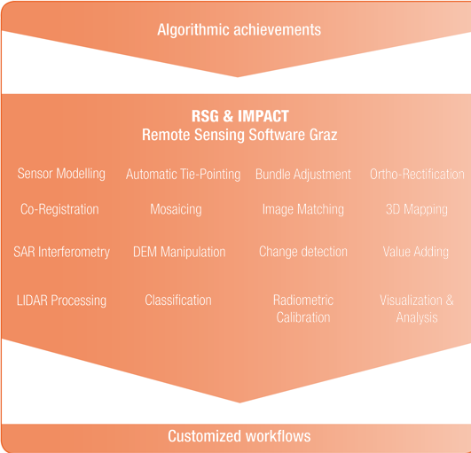
Remote Sensing Software
All-in-one-solution for all Data Types and Sources
Application- specific Toolbox
- Near-real-time direct ortho rectification
- Aerotriangulation
- True ortho-photo generation & image mosaicking (RGB, NIR, thermal)
- DSM / DTM / nDSM production
- Georeferenced multi-sensor image stacks
- 3D mapping (photogrammetry and radargrammetry)
- Large area small scale DSM / DTM / nDSM generation
- Multi-sensor image matching (optical and SAR)
- Surface mapping
- Landslide monitoring
- Ice/glacier movement
- Persistent scattering methods
- Derivation of forest parameters
- Forest stability
- Forest inventory support
- Carbon assessment in tropical countries for REDD initiatives
How it works
- Platform independent, running on Windows and Linux
- Modular design & high flexibility
- Interactive menu-driven & batch operating
- Automatic execution of via command lines & scripts
- Simple creation of processing lines
- Execution of custom-tailored workflows
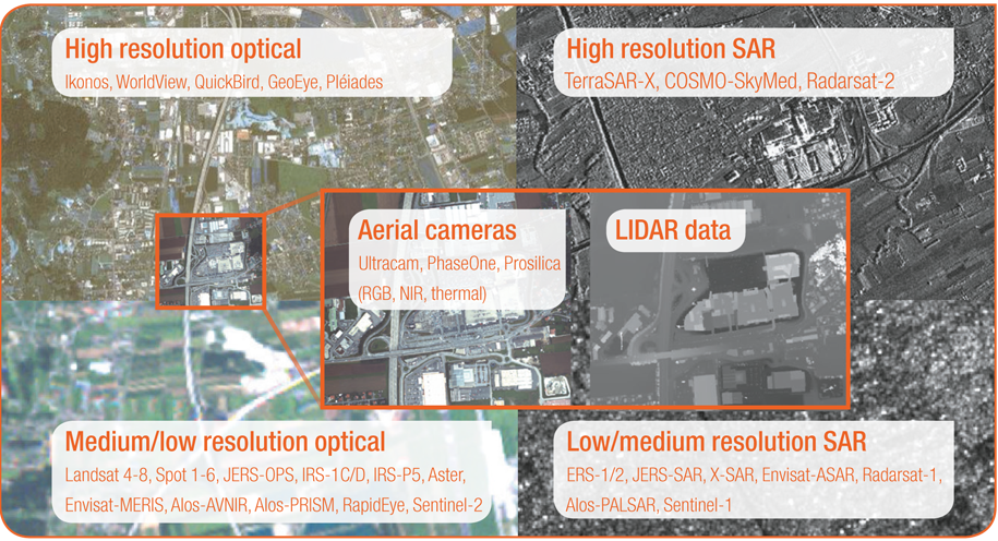
Supporting a Variety of Image Data