Portable Remote Sensing with ADAM
The Out-of-the-Box Solution for Worldwide Application
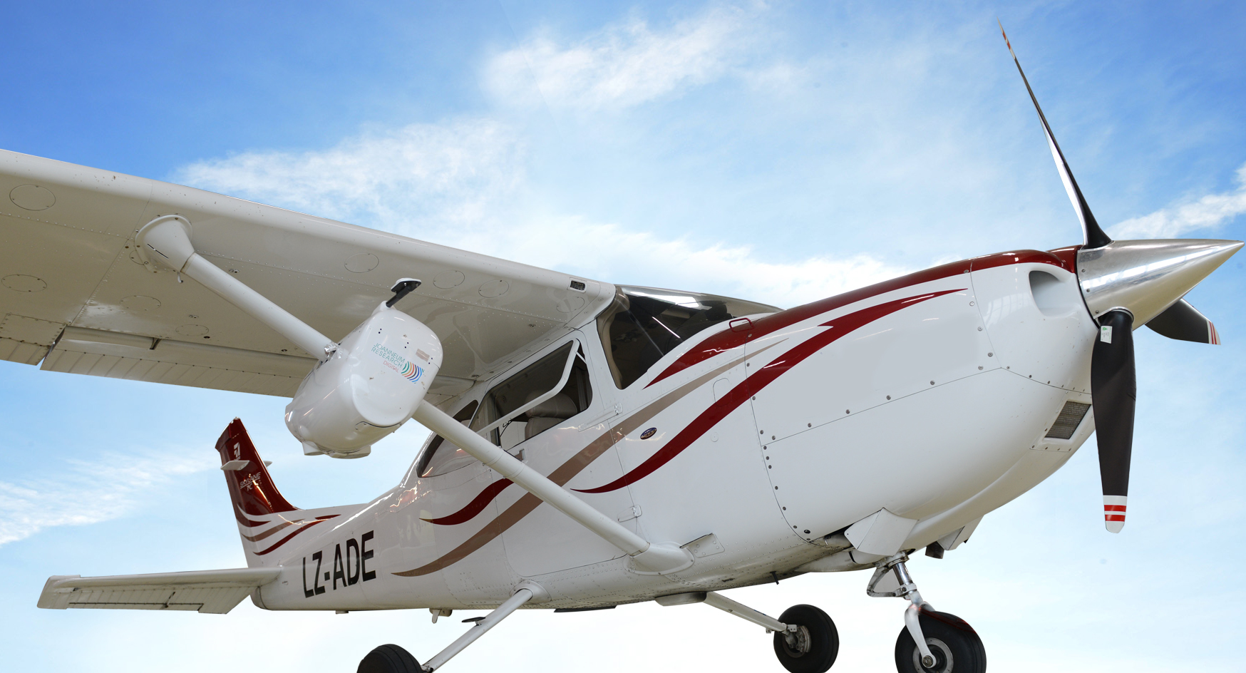
ADAM (=Airborne Data Acquisition & Mapping), the mobile and flexible remote sensing platform can be mounted by a single person in one hour on a rented aircraft. ADAM has been certified and is available for Cessna 182, 182T, 182S and T182T.
Aerial Mapping
- Mobile and flexible remote sensing platform ADAM
- Suitcase solution for world-wide use
- Certified and available for Cessna 182, 182T, 182S and T182T
Software
- DSM/DTM and ortho-photo production with RSG-Photo
- Multi-sensor image stacks with RSG-Photo
- Forest and infrastructure monitoring with IMPACT-LIDAR
Services
- Customized data processing solutions for value adding suppliers
- Consulting & research at the highest possible methodological level
The image processing software calculates an extremly precise tree crown surface model, which when used in combination with a relatively low number of terrestrial survey points provides a low cost determination of forest biomass and carbon stock with high accuracy.
Dr. Michael Kleine, ANRICA Forestry Division
The mobile airborne data acquisition platform allowed us to significantly reduce
the cost of a national forestry inventory program without compromising accuracy.
It makes a big difference in emerging and developing countries whether such an inventory costs 10 or only 5 million euros.
DI Markus Sommerauer, CEO ANRICA