Remote Sensing
Remote Sensing of Natural Resources and Infrastructure
Customer Applications
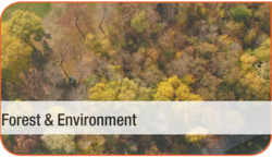
- Forest inventory (local, national, global)
- Monitoring of alpine environment
- Pan-european forest mapping
- Tropical forest mapping
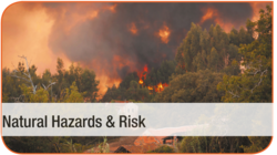
- Land slides
- Rock fall
- Surface subsidence mapping
- Flood events
- Forest fire mapping

- City models
- Corridor mapping (rail, road)
- Powerlines
- Pipelines
- Photogrammetry
- Laser Scanning
- SAR interferometry
- Thematic processing lines
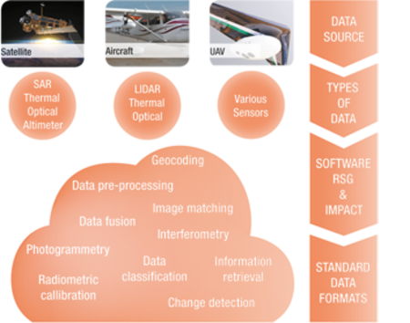
Workflow Solutions
What can we do for you?
- We classify data and generate models for the monitoring of forests and environment, for risk
assessment and infrastructure. - We utilize different data sources (satellite, aircraft, UAV).
- We acquire the data by flying ourselves with our proprietary sensor platform, we can use your data, or we can purchase data for you from third party sources.
Why JOANNEUM RESEARCH?
- Airborne Data Acquisition and Mapping with JOANNEUM RESEARCH Multisensor Plattform ADAM:
Our platform guarantees synchronised sensor data from a range of sensors, according to your
requirements. - Data pre-processing and classification with our own image-processing software RSG: We can adapt the process chains to your specific requirements.
- Our process chains are always at the highest possible methodological level due to our research activities.